Discover the transformative capabilities of Civil Site Design tailored specifically for BricsCAD. Dive into its key features that promise to redefine civil engineering design standards.
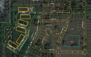
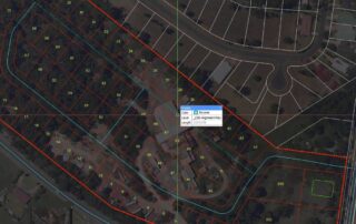
Artificial Intelligence – AI for Subdivision Design
AI for subdivision design reduces the time taken to layout a subdivision road network from hours or days to just minutes. This feature deduces your design intent based on how you name your alignments and learns as you make corrections.
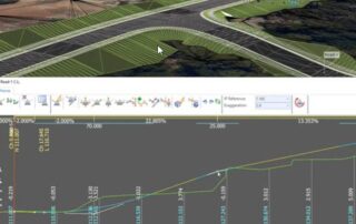
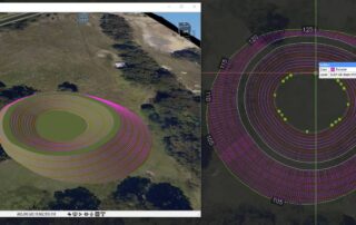
Model Viewer – Real Time Interactive Visualization
Model Viewer offers real-time rendering, allowing designers to see their creations come to life as they work. This real-time interactivity ensures that any design changes can be visualized instantly, eliminating the guesswork and ensuring that the final output aligns perfectly with the designer’s vision.
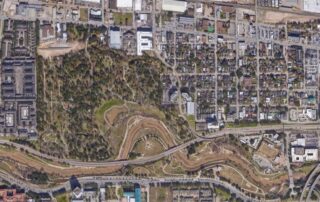
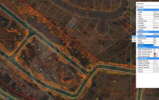
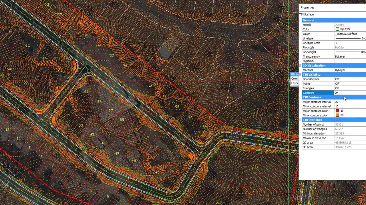
Surfaces From Satellite Data, Point Files
Civil Site Design offers all of the standard tools for creating surfaces from 3D faces, 3D points, contours and point files. You can easily configure the outputs to your standards with the COGO Points features. Civil Site Design also supports reading Civil 3D surfaces and alignments directly from your Civil 3D drawings. The satellite to surface feature will geo-reference your drawing and will use Google elevation data as well as imagery from multiple sources to generate a surface and overlay the image in just minutes.
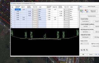
Templates Eliminate Assemblies
Templates provide an intuitive way to define your road, curb, sidewalks, pond elements and related grading polylines. Civil Site Design provides a number of state specific templates that can be easily configured to conform to your standards.
Create Alignments from Polylines
With Civil Site Design alignments are created from polylines either individually or automatically from all polylines on a specified layer. Once created, you have full control of the alignment properties, display characteristics and documentation.
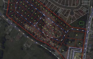
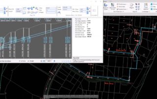
Automated Road Network Design
Once your alignments have been created, you can apply a template and generate the design for an entire subdivision with a single mouse click. You can also create all of your curb returns with a single mouse click saving you hours of time. This time saving process creates an initial vertical design for each road, applies your default template and allows you to view plan, profile and cross-sections simultaneously. All are tied together so changing the vertical design of one road updates all of the connected profiles.
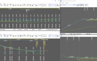
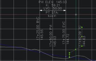
Interactive, Intuitive Design Tools
The interactive design tools allow you to simultaneously access multiple windows of your design. You can open multiple profile views including curb returns and observe changes as a profile is updated. Same with cross-section views. The model viewer tool allows you to see the changes rendered in real time providing an intuitive perspective that helps experienced designers and greatly increases the productivity of new designers.
Grading Tools
Simply using polylines and templates, the grading tools are great for modelling anything from basins, retaining walls, drains, and much more. The Vertical Grading Editor or Grid View can be used to manage the vertical design, while the horizontal geometry can be simply grip edited with real time updates in the drawing and model viewer.
Pipe Design
The pipe design module allows you to easily layout your design with simple polylines, will assign pipes and structures and will generate your network automatically, The Civil Site Design pipe designer, provides a powerful interface that displays pipes in relationship to the ground surface. Pipes are designed automatically based on minimum slope and design flows. Obstructions from other utilities are displayed and color coded based on minimum clearances. Incoming pipes are also displayed and will control the manhole invert where appropriate.
Plan/Profile and Cross Section Generation
Civil Site Design will generate your profiles, plan profile sheets and cross-sections for you with a spectrum of label styles that can be modified to meet your drafting standards.
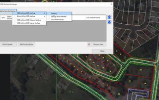
Surface Pasting & Exchange
As you build out your designs, you will often have multiple surfaces such as existing ground, mass grading for a site, ponds, lots and building pads. Civil Site Design provides an intuitive interface to create new surfaces by simply pasting the individual surfaces in order. Civil Site Design will create CAD surfaces that allow you to incorporate these into a BIM environment.